fr
fr en
en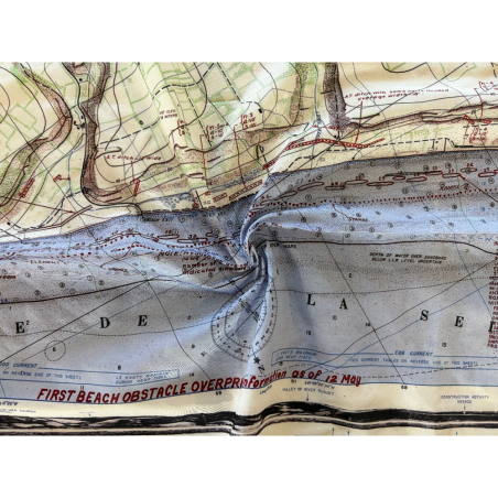

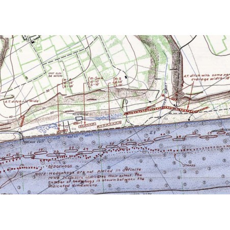


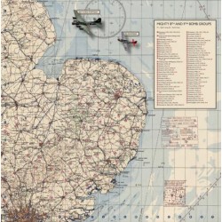
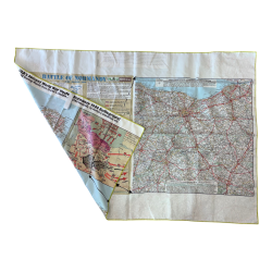
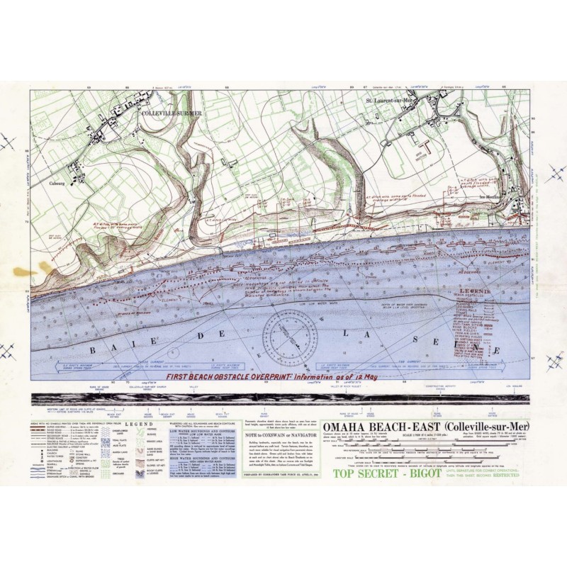
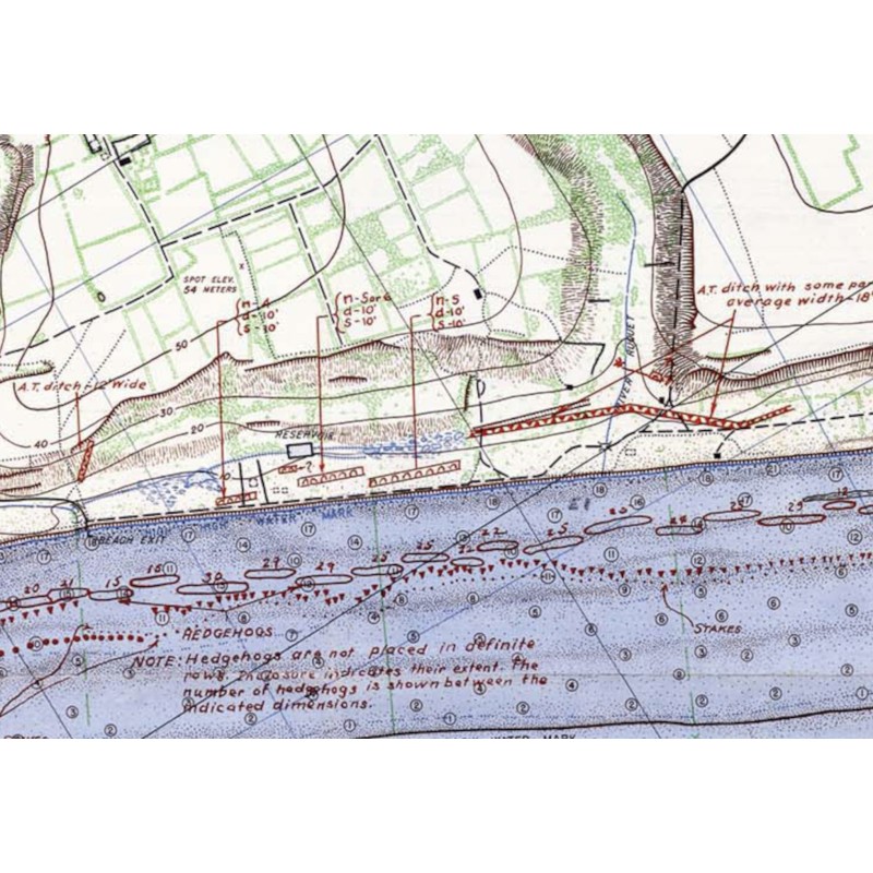
This Bigot Omaha Beach East map is a flexible reproduction of the original map used to guide troops during their landing in Normandy to liberate Europe. This collection of maps comes from British and American military map libraries of the time. The BIGOT classification indicates that this map was subject to the highest level of confidentiality at the time. It features specific details on coastal defences, a profile of the coastline with landmarks, and precise instructions for landing craft bosuns. Omaha Bigot maps are unique in that they are oriented almost from south to north.

International delivery
 Secure Payment
CB / VISA / MASTERCARD / PAYPAL
Flexible card
Dimensions: 50 x 70 cm
You might also like